My sister-in-law, nephew, and I tried to find the alignment of Jupiter and Saturn last night. It was not a well-planned event, but one entered into spontaneous cheer after playing a Shanghai card game. We failed due to a late start and cloud cover. At one point, we thought we saw it, looking southwest, but it turned out to be an airplane flying out of the TRI Cities airport near Kingsport, TN. Jupiter and Saturn would both be visible at 9:35 am on the 22nd and disappear from view around 7:25 pm. And what better place could you possibly go less than an hours drive from Abingdon, VA but White Top Mountain , the second highest mountain in Virginia at 5520 feet.
After consulting my night sky app, we decided the best thing to do was to catch it tonight between 5:30 and 6:30 pm. Jupiter and Saturn would be visible at 9:35 am on the 22nd and disappear from view around 7:25 pm. And what better place could you possibly go less than an hour’s drive from Abingdon, VA but White Top Mountain, the second-highest mountain in Virginia at 5520 feet.
White Top Mountain is near the Mouth of Wilson in Grayson County. This beautiful county is also home to Mount Rogers, which claims the highest peak in Virginia. To get to White Top, you travel along Route 600 (White Top Road) until you get to Mud Creek Lane (FR 89). The trip up this winding gravel road is a little less than two miles. It takes you through various habitats, switchbacks, and gorgeous views. You can see three states from the top of White Top Mountain. It is a favorite spot for birders, and the Appalachian Trail splits the heart of White Top. Did I mention that the DWR site states, “Use caution when driving this road, especially during winter months”?
We left at 4:30 after acquiring an additional passenger, my brother Keith. Loaded with binoculars, hot chocolate, and fudge, we headed to our destination. Mud Creek Lane, as we knew, is covered in packed snow. My nephew, thank goodness, was driving. He is an exceptional driver and knows the roads of Southwest Virginia by heart. We were almost to the parking area when we saw a car stopped in front of us, blocking our route. Up ahead, at the next switchback, a small truck had gone off the road. No one was hurt, except perhaps the vehicle. They went off on the ride back down the mountain. The brave men in our expedition went into the cold night to assess the situation. We discušsed the icy conditions exacerbated by the traffic As well as the precarious position of the truck. Not to mention the tractor attempting to pull it out, the wisdom of old age prevailed over adventure, and we turned around.
Turn around is a simplistic phrase. Over the next ten minutes, we faced an increasingly icy road as John backed my Subaru down the mountain in the dark until we could find a place wide enough to maneuver the vehicle around. Finally, he began to rotate the car into a forward-facing position. There we were, or so it seemed, hovering between the edge of the mountain and the ditch. I wish I could claim to have been a calm passenger, but while I was not hysterical, I did verbalize fear a time or two. We managed the journey back down, sliding just a time or two until we came to Route 600.
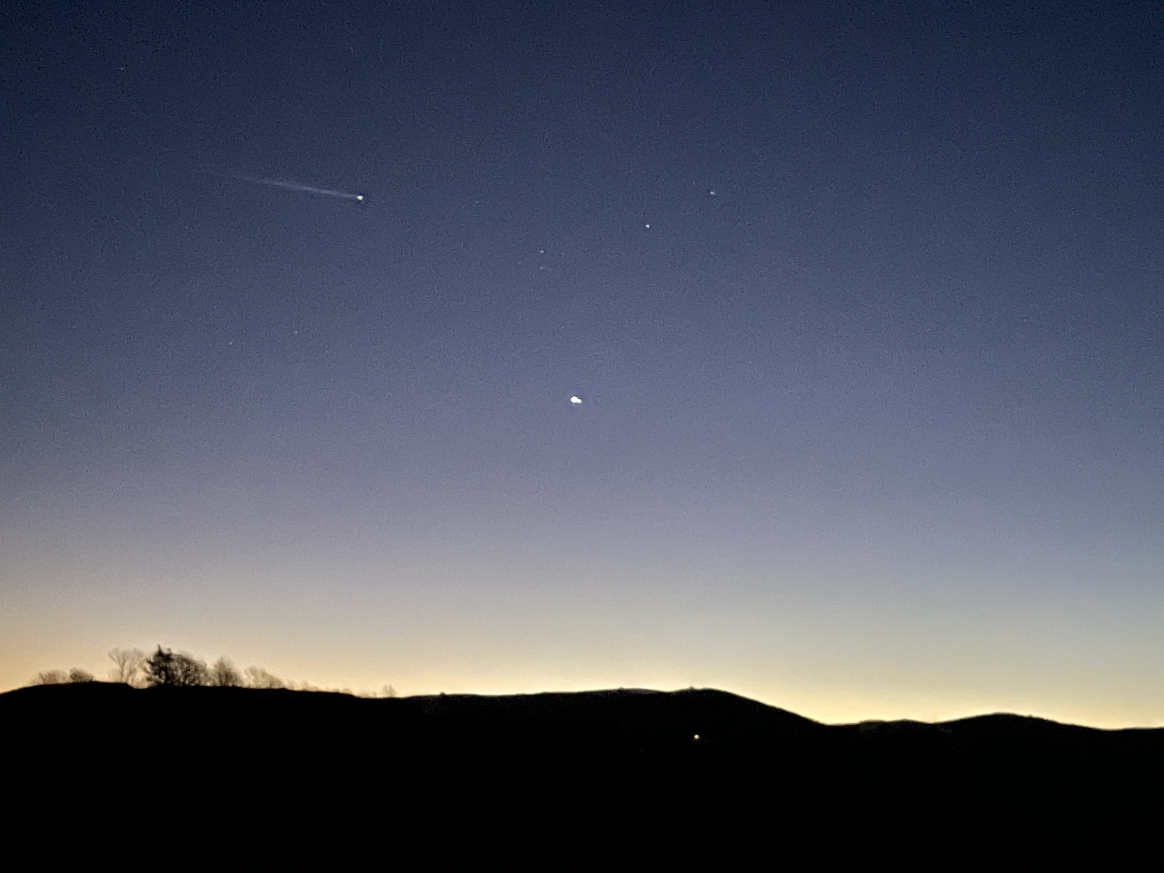
We pulled into The Mt. Rogers Volunteer Fire & Rescue Department parking lot, off of Highway 58. And right in front of us was the South West Sky and a wide-open view of Saturn and Jupiter. We met a fellow stargazer, enjoyed our hot chocolate, and watched the miracle of the Christmas Star.
